IMG_4223.jpg
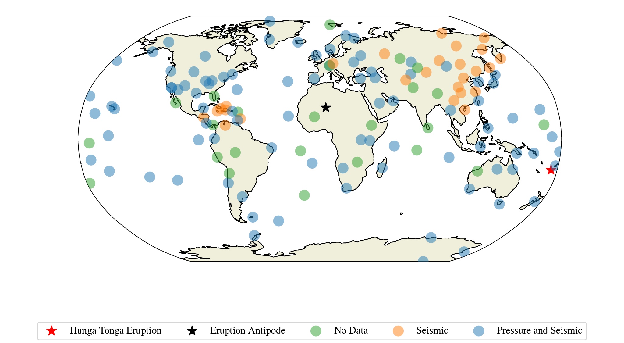
Map of the Global Seismographic Network (GSN) which includes the USGS Caribbean network (network code CU), the IRIS/IDA network (network code II), the IRIS/USGS network (network code IU), and the New China Digital Seismograph Network (network code IC; ASL, 1992). Stations from these networks that did not provide data (e.g., station was down) during the event are depicted by green circles. Stations with both a microbarograph and a seismometer are depicted by blue circles. Stations with only a seismometer are depicted by orange circles. We have included the location of the Hunga Tonga eruption (red star) as well as the antipode (black star).
Ringler et al.
Licence type